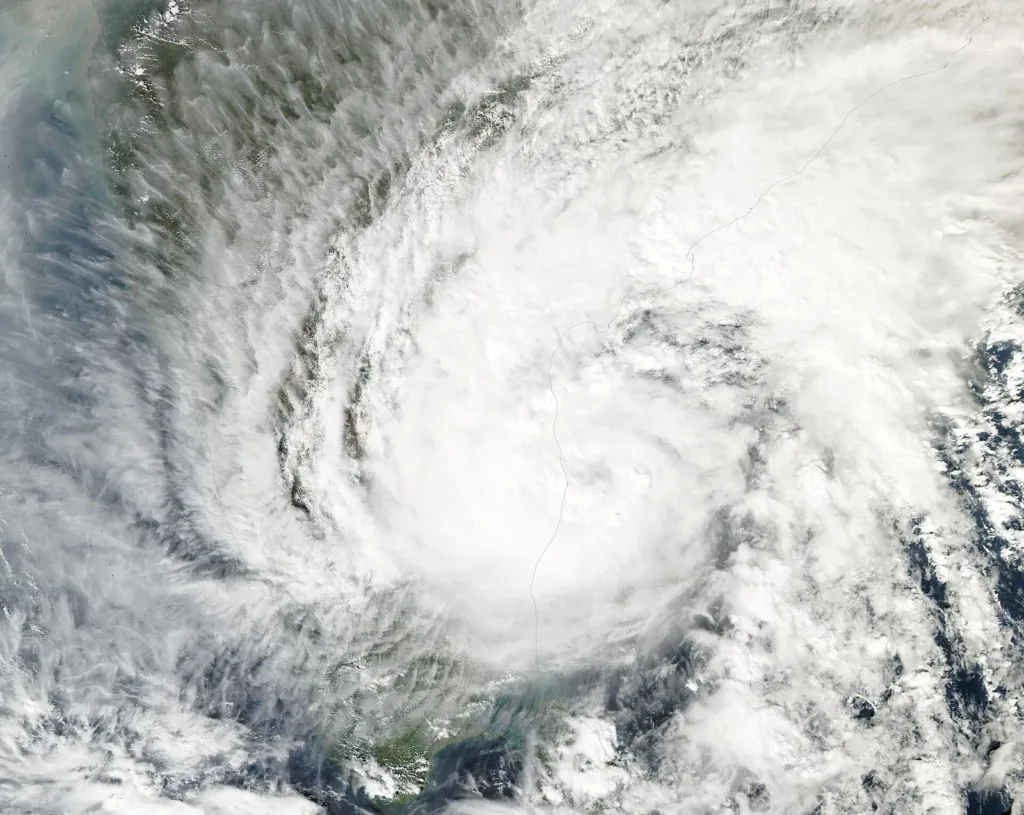
File photo: NASA satellite image of Cyclone Michaung over the Bay of Bengal, December 2023, not Cyclone Arnab. Photo: MODIS Land Rapid Response Team, NASA GSFC, Public domain, Wikimedia Commons

Why it matters
People in coastal Andhra, Yanam and southern Odisha face strong winds, heavy rain and a possible sea surge into low-lying areas while the storm crosses. Power has been switched off in affected areas as a precaution, and dozens of trains, many bus services and flights are cancelled. Heavy rain is expected to continue on Wednesday and Thursday.
The Cyclone Arnab landfall began on the Andhra Pradesh coast early on Wednesday, 28 October 2026, and was still going on at sunrise. The Hindu reported that the very severe cyclonic storm started crossing near Narsapur in West Godavari district at around 1.30 am. At 5.30 am the India Meteorological Department (IMD) said the storm was “practically stationary” along the coast and that the landfall process would continue for another two to three hours, the Press Trust of India (PTI) reported.
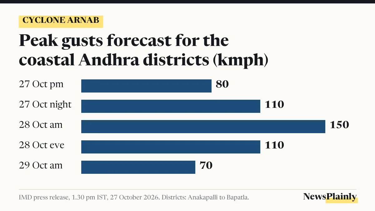
Winds of up to 135 kmph, gusting to 150 kmph, are expected near the centre during that time. Reports reaching the state control room listed fallen trees, power cuts and flooded low-lying areas from Srikakulam in the north to Bapatla in the south, the Hindustan Times reported.
Where the Cyclone Arnab landfall is happening
A cyclone does not hit the coast in one moment: its rain bands reach land first, then its calm centre, the eye, crosses the shoreline. The IMD calls this the landfall process. Its 5.30 am update, as reported by PTI, said the northern spiral band had moved further inland while the centre stayed very close to the coastline.
At that hour the centre was about 30 km east of Narsapur, 45 km south-southwest of Yanam, 70 km south-southwest of Kakinada and 90 km east-northeast of Machilipatnam. The IMD expects it to keep moving northwest and cross the coast between Bapatla and Visakhapatnam, close to the south of Yanam, as a very severe cyclonic storm.
A 6 am bulletin from the Andhra Pradesh State Disaster Management Authority (APSDMA), quoted by the Hindustan Times, gave slightly different distances: about 55 km from Yanam and 70 km from Kakinada. It said gusts of 125 to 135 kmph had been reported in Kakinada, Konaseema and West Godavari districts and would continue for about three more hours.
The exact landfall point is not settled yet. IMD experts told The Hindu it was too early to name it and that a tentative point can be given only once the process is over. An earlier entry on The Hindu’s live page put the start of the process at about 1.20 am rather than 1.30 am.

How the forecast moved in four days
The IMD’s outlook changed twice before the storm reached land: it raised the expected winds, then brought the timing forward. On 25 October it expected a crossing before noon on 28 October with winds of 115 to 125 kmph. By Tuesday afternoon it had raised the wind forecast, and by Tuesday evening it had brought the timing forward because the storm was moving fast.
| When | What the IMD said | Expected winds |
|---|---|---|
| 25 October | Crossing between Bapatla and Visakhapatnam before noon on 28 October | 115 to 125 kmph, gusts 140 |
| 27 October, 1.30 pm release | Crossing close to Yanam by the forenoon of 28 October | 125 to 135 kmph, gusts 150 |
| 27 October, evening | Landfall brought forward to 2 am to 4 am on 28 October, “due to fast movement” | Reports differ (see note) |
| 28 October, about 1.30 am | Landfall process begins near Narsapur | Up to 135 kmph, gusts 150 |
| 28 October, 5.30 am | Storm “practically stationary”; process to last 2 to 3 more hours | Up to 135 kmph, gusts 150 |
The IMD press release of 27 October also set out how the winds would change in the eight coastal districts from Anakapalli to Bapatla. The strongest winds were forecast from early morning to the forenoon of 28 October. After landfall, the release said, winds should ease to 90 to 100 kmph, gusting to 110 kmph, by Wednesday evening, and to 50 to 60 kmph, gusting to 70 kmph, by Thursday morning.
Rain, damage and the rescue work so far
The heaviest rain fell in the north of the state. More than 200 mm was recorded at several places in Anakapalli, Vizianagaram and Visakhapatnam districts between 8.30 am on 27 October and 4 am on 28 October, the IMD said. Kannuripalem in Anakapalli topped the list with 261.5 mm, followed by a station in Vizianagaram district at 259.74 mm and the 16th Police Battalion area in Visakhapatnam at 259.06 mm.
Reports reaching the control room at the state secretariat listed uprooted trees, fallen electricity poles, damaged roads and widespread power cuts, the Hindustan Times reported. Officials told Chief Minister N. Chandrababu Naidu that power had been switched off in affected areas as a precaution. At a teleconference at 6.15 am he told them to clear fallen trees and restore supply once the storm eases, and to stop tanks and canals from overflowing, a government release said.
In Kakinada, police rescued four people who had been cut off by floodwater near the Bombay Katta area, according to a district police press release. In Yanam, the Puducherry enclave next to the expected crossing point, water entered the ground floor of a rehabilitation centre and the people sheltering there were moved upstairs, the Hindustan Times reported.
The state school education department has turned 609 schools into relief centres, which held 854 people at 5.50 am, officials said. Before the storm, Andhra officials had identified 1,763 cyclone shelters, set up 2,907 control rooms and secured 30,043 fishing boats in harbours, the Indian Express reported. In Odisha, the state government had relocated more than 48,000 people from vulnerable areas in eight districts by Tuesday, the same report said.

Trains, buses and flights cancelled
The storm has disrupted rail, road and air travel. Sixty-three trains were cancelled and 15 rescheduled, and the state road transport corporation (APSRTC) cancelled 160 bus services in Visakhapatnam district, the Hindustan Times reported.
At Vijayawada airport, 15 flights were cancelled for Wednesday, including all 12 IndiGo services, an airport official told The Hindu. The Civil Aviation Ministry has said flights to and from coastal Andhra and southern Odisha, including Bhubaneswar, are likely to be the most affected.

What the IMD still warns about
Near the crossing point, the IMD’s sharpest warning is about the sea. The IMD’s 27 October release warned of a storm surge, a rise in sea level pushed ashore by the wind, of 1 to 2 metres above the normal tide, with the highest surge near Kakinada and Yanam. Mint reported a later IMD figure of 1.5 to 2.5 metres. Fishermen have been told not to go to sea off the Andhra and Odisha coasts until 29 October.
The same release warned of uprooted small trees, damage to standing crops, huts and kutcha houses, and disrupted road and rail traffic. State officials expect heavy rain to continue on Wednesday and Thursday. Telangana’s Khammam, Bhadradri Kothagudem, Mulugu and Mahabubabad districts are under a red alert for Wednesday, The Hindu reported.
Help numbers and travel checks
Kakinada police have asked people not to go outdoors unless it is necessary and to stay away from flooded areas. Anyone trapped or needing help can call Dial 112 or the Kakinada Police Control Room. Rail passengers will get changes by SMS on the number given at booking, and can check train status on the IRCTC, RailOne and NTES apps or by calling 139, South Central Railway said.
Earlier NewsPlainly coverage of the forecast is here, and the IMD’s own 27 October press release has the district warnings.
Frequently asked questions
Has Cyclone Arnab made landfall?
Its landfall process began near Narsapur at around 1.30 am on 28 October. At 5.30 am the IMD said the process was still under way and would last another 2 to 3 hours.
Where is Cyclone Arnab crossing the coast?
Between Bapatla and Visakhapatnam, close to the south of Yanam, the IMD says. At 5.30 am the centre was about 30 km east of Narsapur and 70 km south-southwest of Kakinada.
How strong are the winds?
The IMD expects sustained winds of up to 135 kmph near the centre, with gusts of 150 kmph. Officials reported gusts of 125 to 135 kmph in Kakinada, Konaseema and West Godavari.
Which number should I call for help in Kakinada?
Police asked people in need to call Dial 112 or the Kakinada Police Control Room. Train status is on the IRCTC, RailOne and NTES apps or 139.